In construction documentation, a building elevation drawing shows the angle projections of all structure sections from a given direction. They are crucial to the likes of architects for many reasons, and in this article, we will outline the main ones.
Planning permission
Local authorities often demand that architects show elevation drawings as part of their approval procedure. These designs illustrate adherence to height constraints, setback requirements, and other local rules.
Municipal planning boards and authorities utilise drawings to analyse the visual effect of proposed constructions on their surroundings. The drawings assist in making educated conclusions regarding the design’s suitability for the context of the area.
Communication of designs
Elevation drawings are vital when it comes to communicating design ideas to customers. They give a clear and realistic image of how the building is going to look from various angles, allowing customers to visualise the finished construction.
Architects, engineers, and other members of the design team also utilise architectural drawings to collaborate on the final design. These drawings guarantee that everyone working on the project has a common idea of the building’s outside look.
Record purposes
During the course of building construction projects, adjustments often happen as a result of unanticipated events on-site. Whether they are little or significant, these changes need to be documented.
In order to provide evidence of what has been constructed, the customer will frequently request record drawings, also known as “as-built” drawings. Generally speaking, elevation surveys are utilised in order to produce a record drawing that is exact of the exterior of a structure. In order to capture any modifications that have occurred, this final drawing can be compared to the planning drawings.
Building refurbishment
Elevation surveys are a useful tool when if you need to measure and survey the existing structure of a building that is going to be renovated. It is essential to the success of the project that building elevation drawings be created from the existing structure and be measured and surveyed in this way.
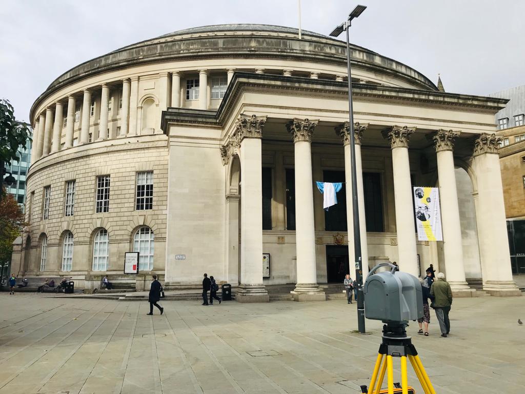
Using three-dimensional laser scanning, elevation surveys can be utilised to generate a map of the facade of the structural structure. A Faro laser scanner is utilised by Landform Surveys in order to deliver high-speed data gathering and communication of the highest possible quality. This instrument is able to scan up to one million points per second.
Right to light purposes
There are tight regulations in the UK about how much natural light must be let into a space. The goal of these regulations is to guarantee that natural light is available to all. Half of the space in a commercial building should be illuminated by natural light. In your house, natural light should illuminate slightly more than half of the space.
In England and Wales, the Prescription Act 1832 provides protection against adverse possession and common law rights to natural light. New building projects may occasionally violate the right to light regulations because their elevation would put existing structures in shadow.
Building elevation drawings taken from elevation surveys can be used to undertake a right to light survey, so during the planning stages, individuals can be assured their buildings meet required standards.
Building elevation drawings from Landform Surveys
Landform Surveys has worked with a wide range of clients across the UK to produce detailed, accurate elevation surveys for various uses. An elevation survey will mean you are able to future-proof your structure, saving time, money, and hassle later on.
Get in touch with the team today to discuss your elevation survey brief.

