Mitigate project delays and unforeseen costs with Underground Utility Surveys from Lucion’s Geospatial team. Safeguard your project, people, and the planet.
Underground Utility Surveys serve as your first line of defence, providing crucial insights into subsurface infrastructure. From gas pipes to drainage systems, our advanced technology, including ground-penetrating radar (GPR) and electromagnetic locators, ensures unparalleled accuracy.
We adhere to the PAS128 standard, ensuring reliable and consistent delivery of underground utility information. Compliant with British Standards Institution guidelines, PAS128 minimises dangers, conflicts, delays, and disruptions to your project.
PAS 128 Survey Category Type A
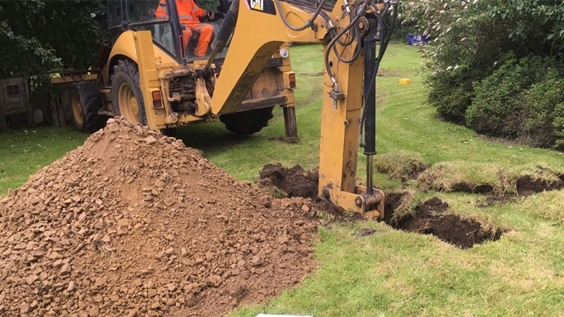
We confirm the presence and location of utilities through physical identification methods. Our Utility Clearance Surveys break ground and may include strategically positioned vacuum excavation, hand-dug trial pitting, or visual inspection within a utility chamber.
PAS 128 Survey Category Type B
An on-site utility mapping survey using multiple geophysical instruments. The results of this survey will represent each 5-meter linear section of utility, depicted with a Quality Level (QL) of 1-4 for horizontal and vertical detection accuracy.
PAS 128 Survey Category Type C
Underground utilities are mapped solely from utility record data, supplemented by site reconnaissance to align the utility records with the physical utility street furniture for the best fit.
PAS 128 Survey Category Type D
Our Desktop Utility Surveys involve a comprehensive desktop search of all statutory asset owners to obtain their record data. This is sometimes referred to as a C2 Search.
Before breaking ground, understanding what lies beneath is paramount. Accidental interference with water, power, gas, or sewage pipes can lead to costly setbacks, legal issues, and safety concerns.
Our utility surveys mitigate these risks, offering a comprehensive map of subsurface utilities, aiding in informed decision-making during planning and design. Uncover the invisible risks below for a safer and more efficient construction journey with Utility Surveys from Lucion, where precision meets safety.


